Language : Urdu
Phone Code : 0992
Introduction
The District of Abbottabad is the headquarters of Hazara Division and the
summer capital of the North West Frontier Province (NWFP) Government.
Abbottabad is named after its founder, Maj. James Abbott, the first Deputy
Commissioner of Hazara.
Historical Background
The city of Abbottabad was founded in 1853 by Maj. James Abbott, who was
the first Deputy Commissioner of Hazara District. Hazara remained a
District right upto its conversion into a Division in 1976. In October
1976, Mansehra was given the status of a full fledged District, which
consisted of Mansehra and Batagram Tehsils. Subsequently in July 1991,
Haripur Tehsil was separated from Abbottabad and made into a District.
Thus only the old Tehsil of Abbottabad remained, which was declared as
Abbottabad District.
Population of District Abbottabad
The total population of District Abbottabad was 881,000 according to the
Census of 1998. The annual growth rate of population during 1981-1998 was
1.82%. Population density is 447.7 persons per Sq. KM in March 1998. The
ratio of urban and rural population is 18:82. The gender ratio (i.e. the
number of males per hundred females) of the District is 100.2, where it is
94.96 in rural areas and 128.08 in urban areas.
Culture of District Abbottabad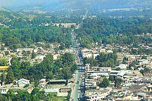
Languages
Hindko is the major language of the District. According to the 1998
Census, 94.26% of the total population speaks Hindko. Other languages
spoken in the District are Urdu– 1.05%, Pushto– 2.22% and Punjabi– 2.30%.
Customs and Traditions
Abbottabad is well-cultured area, modern and ancient cultures are combined
here. Although the young generation is found of modern culture but
religious bonds are very tight and majority of the population like the
Islamic traditions and follow the path of Allah. The Hujra meetings
(sitting) are also included in the customs. The Islamic traditions are
outstanding in rural area and have high moral values in the society.
Dresses
Common dress of the people is Shalwar Qamiz, however Government officials
and students use trousers and coats. Turban, Kraquli, Patti caps are worn
by the people. Men often wear Waistcoats and Coats over Shalwar Qamiz.
Women’s dresses are also very simple and consist of Shalwar, Qamiz,
Dopatta and Chadder.
Cuisine
The food of inhabitants of the District is very simple. Maize, wheat and
rice are eaten everywhere. Desi Ghee and Lassi is used eagerly in the
rural areas.
Occupations in District Abbottabad
A large majority of the population– (60%) depends upon agriculture for
their subsistence. However, income from agriculture is too meager to
support the population. As a result, many of them have found work in other
parts of the country or left for abroad. Other minor professions to which
people have taken to, include those of cobblers, blacksmiths, goldsmiths,
weavers, barbers, washermen, labourers etc.
Point of interest for Tourism in District Abbottabad.
Abbottabad as Gateway to Silk Route.
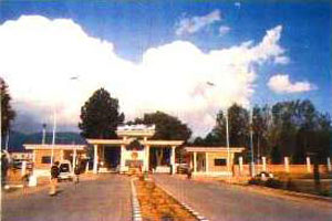
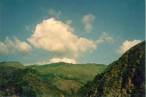
Abbottabad is a small neat and clean town in a spacious valley surrounded
by green hills. It is a popular summer resort, located at the end of
Murree-Abbottabad hill tract at a height of 1,220 meters, noted for its
verdant parks, gardens, golf course and pine covered hills. Abbottabad,
apart from being famous for its educational institutions and Military
Academy, also serves as the gateway to most beautiful places in Pakistan.
The formidable Karakorams, the enchanting Himalayas and the deadly
Hindukush, can also be approached from Abbottabad. Though the importance
of the city has been diminished a little by the completion of Karakoram
Highway because, in the past, the only track available to reach Karakoram
was through Babusar Pass, which in its turn, could only be approached
through Abbottabad. In spite of this development, the city continues to be
a transit city for tourists. Abbottabad is the junction from where one can
go to places like Hunza, Gilgit, Skardu and Indus Kohistan, of the
Karakoram Range. One can reach Swat, Swati Kohistan, Dir and Chitral of
the Hindukush Range. One can approach Naran, Saif-ul-Muluk Lake, Shogran
and Babusar Pass of the Himalayan Range. Neelum, Lipa and Jhelum Valley of
beautiful Azad Kashmir are also connected through Abbottabad.
While other hill stations are deserted during winter this place has
visitors due to the bracing winter. The place has beautiful gardens,
Jinnah Garden, Ladies Garden and another garden maintained by the
Cantonment Board. To the splendid stretch of turf with plenty of room for
polo, football, hockey and golf. At the back of the station, to the West,
is the Brigade Center, ideal for walks and picnic. The Cantonment area of
Abbottabad is still very British. The European bungalows, the club, the
church and cemetery are still there. Abbottabad is an hour's drive from
Nathiagali, the summer capital of the North West Frontier Province,
emerging steeply through beautiful valleys with trees right to the
riverbed.
Ayubia Chair Lifts.
A cluster of four small hill stations of Khanaspur, Khairagali,
Changlagali and Ghora Dhaka is called Ayubia and was named after former
President Ayub Khan. The complex is spread over an area of 26 KM. The
central place of Ghora Dhaka has Chair Lifts, which gives a panoramic and
mesmerizing view of the surrounding. Ayubia is 38 KM from Abbottabad.
Dungagali.
Dungagali is a picturesque small resort situated on the slopes of the
Mukshpuri hill (2,376 meters.). It commands a charming view of a series of
wooded spurs projecting towards the river Jhelum on the western side. From
Dungagali one can climb the 2,813 meters peak of Mukhshpuri, which is the
highest point in the range. Natural springs abound on the slopes. It is 34
KM from Abbottabad.
Nathiagali.
Nathiagali is clad in pine, walnut, oak and maple trees, is the prettiest
hill resort in the Galliat region. It can be approached both from Murree
and Abbottabad. It is 32 KM from Abbottabad as well as from Murree.
Nathiagali is 2501 meter above sea level and is surrounded by lush green
lofty mountains. Breathtaking landscapes, spring water and fresh air make
it one of the most peaceful hill stations in Pakistan.
Thandiani.
Thandiani means “cold” in the local language. Therefore being a cool place
it got the name of “Thandiani”. It is 2,700 meters above sea level on a
small plateau surrounded by pine forests. This beautiful spot can easily
be approached from Abbottabad, and is 31 KM from main Abbottabad City and
25 KM from Thandiani-Nathiagali crossing. The drive takes more or less 80
minutes from Abbottabad with lovely views on both sides of the road. The
road rises more than 1,219 meters above Abbottabad. On the way along with
tall majestic pine trees you come across groups of monkeys. The major
place on the way is Kalapani at 23 KM from Abbottabad. It has a beautiful
local Dak bungalow. Hule Ka Danna is about two KM North of Thandiani. It
is one of the most beautiful glades in the region.
Thandiani offers lush green lovely views. At night the lights of
Abbottabad District and Azad Kashmir are clearly visible. To the East
beyond the Kunhar River, may be seen the snow covered mountain ranges of
Kashmir, to the North and NorthEast, the mountains of Kohistan and Kaghan
are sighted, to the NorthWest are the snowy ranges of Swat and Chitral.